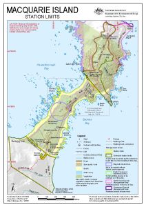
Map 14706: Macquarie Island: Station Limits
Map details
| Map Number | 14706 |
| Title | Macquarie Island: Station Limits |
| Edition | 4 (Out of Date) |
| Previous edition | [Previous edition : 3] |
| Next Edition | [Next Edition : 5] |
| Scale | 1 : 7800 |
| Publication date | March 2019 |
| Publisher |
Australian Antarctic Division (Australia)
|
| Spatial coverage |
(158.9253° -54.4914°)
,
(158.9481° -54.4914°)
,
(158.9481° -54.5089°)
(158.9253° -54.5089°) |
| Projection | Universal Transverse Mercator |
| Physical size | 29.7 x 21 cm A4 |
| Notes |
© Commonwealth of Australia 2019 . |
| Keywords | Hasselborough Bay , Buckles Bay , Tern Rock , Secluded Beach , Catch Me Point , Cosray Rocks , Landing Beach , Wireless Hill , Lambing Gully , Garden Bay , Hayter Rock , Tottan Head |
Downloads
This is a digital map available for downloading.
Map Lists
No maps lists available.
Additional Information
| Horizontal datum | WGS84 |
| Vertical datum | Mean sea level |
| Vertical unit | Metres |
| Nomenclature | Tractor Rock is an unofficial name. Names of other geographic features have been approved by the Nomenclature Board of Tasmania. |
Preview