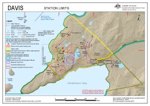
Map 15274: Davis: Station Limits
Map details
| Map Number | 15274 |
| Title | Davis: Station Limits |
| Edition | 5 (Out of Date) |
| Previous edition | [Previous edition : 4] |
| Next Edition | [Next Edition : 6] |
| Scale | 1 : 10 000 |
| Publication date | July 2019 |
| Publisher |
Australian Antarctic Division (Australia)
|
| Spatial coverage |
( 77.9415° -68.5686°)
,
( 78.0097° -68.5686°)
,
( 78.0097° -68.5836°)
( 77.9415° -68.5836°) |
| Projection | Universal Transverse Mercator |
| Physical size | 21 x 29.7 cm A4 |
| Notes |
© Commonwealth of Australia 2019 . |
| Keywords | Heidemann Bay , Ski Landing Area , O'Gorman Rocks , Torckler Rocks |
Downloads
This is a digital map available for downloading.
Map Lists
No maps lists available.
Additional Information
| Horizontal datum | WGS84 |
| Vertical datum | Mean sea level |
| Vertical unit | Metres |
| Nomenclature | Australian Antarctic Gazetteer |
Preview