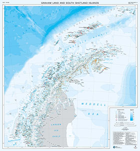
Map 15299: Graham Land and South Shetland Islands
Map details
| Map Number | 15299 |
| Title | Graham Land and South Shetland Islands |
| Edition | 7 |
| Previous edition | [Previous edition : 2] |
| Scale | 1 : 1 000 000 |
| Publication date | 2017 |
| Publisher |
British Antarctic Survey (United Kingdom)
|
| Spatial coverage |
( -68.0000° -60.8333°)
,
( -53.0000° -60.8333°)
,
( -53.0000° -68.3333°)
( -68.0000° -68.3333°) |
| Projection | Polar Stereographic |
| Physical size | 90 x 84 cm |
| Notes | This is side A of a double-sided map. Side B contains a map of the 'Scotia Sea' (Map Number 15300). For more information see https://www.bas.ac.uk/data/our-data/maps/topographic-maps/scotia-seagraham-land-and-south-shetland-islands/ |
| Reference | BAS (UKAHT) 1A |
| Keywords | Graham Land , South Sandwich Islands , Larsen Ice Shelf , James Ross Island , Adelaide Island |
Downloads
No downloads available.
Map Lists
No maps lists available.
Additional Information
| Horizontal datum | WGS84 |
| Vertical unit | Metres |
| Nomenclature | UK Antarctic Place-names gazetteer |
Preview