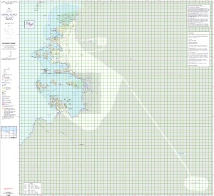
Map 15661: Windmill Islands - Casey to Wilkins Aerodrome (Digital Only)
Map details
| Map Number | 15661 |
| Title | Windmill Islands - Casey to Wilkins Aerodrome (Digital Only) |
| Edition | 2 (Out of Date) |
| Previous edition | [Previous edition : 1] |
| Next Edition | [Next Edition : 3] |
| Scale | 1 : 50 000 |
| Publication date | December 2021 |
| Publisher |
Australian Antarctic Division (Australia)
|
| Spatial coverage |
(110.3225° -66.1736°)
,
(111.0722° -66.1736°)
,
(111.0722° -66.5856°)
(110.3225° -66.5856°) |
| Projection | Universal Transverse Mercator |
| Physical size | 128 x 138 cm |
| Notes | Georeferenced PDF for digital use only |
| Keywords | Browning , Peninsula , Robinson , Ridge , Mitchell , Bailey , Clark , Newcomb , O'brien , Sparkes , Penney , Eyres , Robertson , Heigel , Knowles , Vanderford , Peterson. |
Downloads
This is a digital map available for downloading.
Map Lists
No maps lists available.
Additional Information
| Horizontal datum | WGS84 |
| Vertical datum | Mean sea level |
| Nomenclature | Australian Antarctic Gazetteer |
Preview