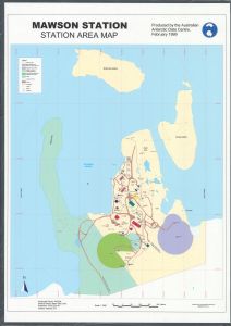
Map 15722: Mawson Station - Station Area Map
Map details
| Map Number | 15722 |
| Title | Mawson Station - Station Area Map |
| Edition | 2 (Out of Date) |
| Previous edition | [Previous edition : 1] |
| Next Edition | [Next Edition : 3] |
| Scale | 1 : 1500 |
| Publication date | February 1999 |
| Publisher |
Australian Antarctic Division (Australia)
|
| Spatial coverage |
( 62.8583° -67.5934°)
,
( 62.8861° -67.5934°)
,
( 62.8861° -67.6076°)
( 62.8583° -67.6076°) |
| Projection | UTM Zone 41 |
| Physical size | 119 x 84.5 cm |
| Keywords | Mawson , station area , station limits |
Downloads
This is a hard copy map that has been scanned. See information about obtaining copies of hard copy maps.
Map Lists
No maps lists available.
Additional Information
| Horizontal datum | WGS84 |
| Vertical datum | msl |
| Vertical unit | Metres |
Preview