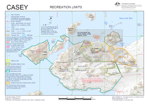
Map 15766: Casey: Recreation Limits
Map details
| Map Number | 15766 |
| Title | Casey: Recreation Limits |
| Edition | 9 (Out of Date) |
| Previous edition | [Previous edition : 8] |
| Next Edition | [Next Edition : 10] |
| Scale | 1 : 15 500 |
| Publication date | 01 October 2022 |
| Publisher |
Australian Antarctic Division (Australia)
|
| Spatial coverage |
(110.4639° -66.2712°)
,
(110.5587° -66.2712°)
,
(110.5587° -66.2944°)
(110.4639° -66.2944°) |
| Projection | Universal Transverse Mercator |
| Physical size | 21 x 29.7 cm A4 |
| Notes |
© Commonwealth of Australia 2017 . |
| Keywords | ASPA 135 , Shirley , Schulz , Phelps , Nicholson , McMullin , Kilby , Bailey , Collins , Budnick , Reeve , Crane , Brown , Thala |
Downloads
This is a digital map available for downloading.
Map Lists
No maps lists available.
Additional Information
| Horizontal datum | WGS84 |
| Vertical datum | Mean sea level |
| Vertical unit | Metres |
| Magnetic variation | Magnetic North is 101 degrees west of True North |
| Nomenclature | Australian Antarctic Gazetteer |
Preview