Map 15862: Larsemann Hills - Details of northern Broknes
Map details
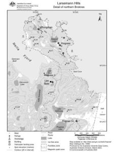
| Map Number | 15862 |
| Title | Larsemann Hills - Details of northern Broknes |
| Edition | - |
| Scale | 1 : 25 000 |
| Publication date | March 2023 |
| Publisher |
Australian Antarctic Division (Australia)
|
| Spatial coverage |
( 76.3452° -69.3672°)
,
( 76.4260° -69.3672°)
,
( 76.4260° -69.4034°)
( 76.3452° -69.4034°) |
| Projection | UTM 45 |
| Physical size | 20 x 15 cm |
| Keywords | - |
Downloads
This is a digital map available for downloading.
Map Lists
This map belongs to the following lists. Use the link on the list to see all maps belonging to that list
Additional Information
| Horizontal datum | WGS 84 |
| Vertical unit | Metres |
Preview