Map 15985: Casey final helicopter approach (Helicopter Operations)
Map details
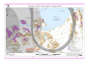
| Map Number | 15985 |
| Title | Casey final helicopter approach (Helicopter Operations) |
| Edition | 8 |
| Previous edition | [Previous edition : 7] |
| Scale | 1 : 10 000 |
| Publication date | October 2023 |
| Publisher |
Australian Antarctic Division (Australia)
|
| Spatial coverage |
(110.5133° -66.2741°)
,
(110.5711° -66.2741°)
,
(110.5711° -66.2886°)
(110.5133° -66.2886°) |
| Projection | UTM Zone 49 |
| Physical size | 21 x 29.7 cm A4 |
| Keywords | - |
Downloads
This is a digital map available for downloading.
Map Lists
This map belongs to the following lists. Use the link on the list to see all maps belonging to that list
Additional Information
| Horizontal datum | WGS84 |
Preview