Map 15986: Casey fixed-wing suggested flight path
Map details
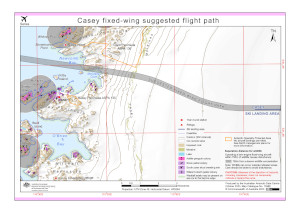
| Map Number | 15986 |
| Title | Casey fixed-wing suggested flight path |
| Edition | 4 |
| Previous edition | [Previous edition : 3] |
| Scale | 1 : 55 000 |
| Publication date | October 2023 |
| Publisher |
Australian Antarctic Division (Australia)
|
| Spatial coverage |
(110.4542° -66.2472°)
,
(110.7803° -66.2472°)
,
(110.7803° -66.3278°)
(110.4542° -66.3278°) |
| Projection | Universal Transverse Mercator |
| Physical size | 21 x 29.7 cm A4 |
| Keywords | ASPA 135 , ASPA 136 , Loken Moraines , Clark Peninsula , Whitney Point , Stonehocker Point , Wilkes , Newcomb Bay , McGrady Cove , Shirley Island , McMullin Island , Kilby Island , Beall Island , Mitchell Peninsula , Bailey Peninsula , O'Brien Bay |
Downloads
This is a digital map available for downloading.
Map Lists
This map belongs to the following lists. Use the link on the list to see all maps belonging to that list
Additional Information
| Horizontal datum | WGS84 |
| Vertical datum | Mean Sea Level |
| Nomenclature | Australian Antarctic Gazetteer |
Preview