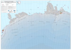
Map 16055: MAP 18: Rauer Group to Bunger Hills
Map details
| Map Number | 16055 |
| Title | MAP 18: Rauer Group to Bunger Hills |
| Edition | 1 |
| Scale | 1 : 1 000 000 |
| Publication date | December 2023 |
| Publisher |
Australian Antarctic Division (Australia)
|
| Spatial coverage |
( 75.3000° -64.1800°)
,
(107.9300° -64.1800°)
,
(107.9300° -71.1700°)
( 75.3000° -71.1700°) |
| Projection | Polar Stereographic |
| Physical size | 84.1 x 118.9 cm |
| Reference | ISBN: 978-0-948277-50-4 |
| Alternative title | Air Operations Planning Maps |
| Keywords | Air Operations Planning |
Downloads
This is a digital map available for downloading.
Map Lists
This map belongs to the following lists. Use the link on the list to see all maps belonging to that list
Additional Information
| Horizontal datum | WGS84 |
| Vertical datum | Mean Sea Level |
| Vertical unit | Feet |
| Nomenclature | All names are from the SCAR Composite Gazetteer of Antarctica |
Preview