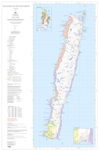
Map 16161: Macquarie Island Environment
Map details
| Map Number | 16161 |
| Title | Macquarie Island Environment |
| Edition | 6 |
| Previous edition | [Previous edition : 5] |
| Scale | 1 : 50 000 |
| Publication date | April 2024 |
| Publisher |
Australian Antarctic Division (Australia)
|
| Spatial coverage |
(158.7400° -54.4700°)
,
(158.9800° -54.4700°)
,
(158.9800° -54.7900°)
(158.7400° -54.7900°) |
| Projection | Transverse Mercator |
| Physical size | 70 x 50 cm A1 |
| Notes | Georeferenced PDF intended for digital use only. |
| Alternative title | macquarie_island_50k_400dpi_single_sheet_16161 |
| Keywords | Macquarie Island , Southern Ocean , Subantarctic , Sub-Antarctic , Station , North Head , Survey Marks , Topographic |
Downloads
This is a digital map available for downloading.
Map Lists
This map belongs to the following lists. Use the link on the list to see all maps belonging to that list
Additional Information
| Horizontal datum | WGS84 |
| Vertical unit | Metres |
| Nomenclature | Australian Antarctic Gazetteer |
Preview