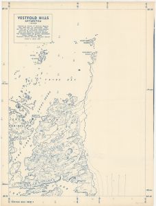
Map 1752: Vestfold Hills, Antarctica 1958 1:20,000 (Sheet 2)
Map details
| Map Number | 1752 |
| Title | Vestfold Hills, Antarctica 1958 1:20,000 (Sheet 2) |
| Edition | - |
| Scale | 1 : 20 000 |
| Publication date | June 1958 |
| Publisher |
Australia
|
| Spatial coverage |
( 78.3333° -68.3333°)
,
( 78.6667° -68.3333°)
,
( 78.6667° -68.5000°)
( 78.3333° -68.5000°) |
| Projection | Universal Transverse Mercator |
| Physical size | 102 x 83 cm |
| Notes |
Compiled from air photographs flown Jan. 1957 and Feb. 1958 using slotted templates controlled by astronomical fixations at Davis and Barrier Is.. Contours obtained from barometer heights and parallax measurements. Revised to March 1959. |
| Reference | S1/137 Sheet 2, Vestfold Hills Sheet 2 |
| Keywords | Vestfold Hills , Tryne Sound , Barrier Island , Pioneer Crossing , Luncke Ridge , Long Fjord , Wyatt Earp Islands , Walkabout Rocks |
Downloads
This is a hard copy map that has been scanned. See information about obtaining copies of hard copy maps.
Map Lists
No maps lists available.
Additional Information
| Vertical unit | Metres |
Preview