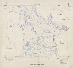
Map 1826: SQ 39-40/11 D Aker Peaks
Map details
| Map Number | 1826 |
| Title | SQ 39-40/11 D Aker Peaks |
| Edition | - |
| Scale | 1 : 100 000 |
| Publication date | November 1966 |
| Publisher |
Department of National Development, Division of National Mapping (Australia)
|
| Spatial coverage |
( 55.5000° -66.5000°)
,
( 57.0000° -66.5000°)
,
( 57.0000° -67.0000°)
( 55.5000° -67.0000°) |
| Projection | Universal Transverse Mercator |
| Physical size | 76 x 81 cm |
| Reference | SQ 39-40/11-D, NMP/61/8 |
| Keywords | Aker Peaks , Kemp Land , Seaton Glacier , Wilson Glacier , Downer Glacier , King Edward Plateau , Edward VIII Gulf , King Edward Ice Shelf , SQ39-40 |
Downloads
This is a hard copy map that has been scanned. See information about obtaining copies of hard copy maps.
Map Lists
No maps lists available.
Additional Information
| Vertical unit | Metres |
Preview