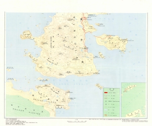
Map 2068: Fildes Peninsula, King George Island
Map details
| Map Number | 2068 |
| Title | Fildes Peninsula, King George Island |
| Edition | - |
| Scale | 1 : 10 000 |
| Publication date | - |
| Publisher |
China
|
| Spatial coverage |
( -59.0500° -62.1958°)
,
( -58.8917° -62.1958°)
,
( -58.8917° -62.2542°)
( -59.0500° -62.2542°) |
| Projection | Gauss Kruger |
| Physical size | - |
| Reference | Part 2 |
| Keywords | Fildes Peninsula , King George Island , Topographic |
Downloads
No downloads available.
This is a hard copy map. See information about obtaining copies of hard copy maps.
Map Lists
No maps lists available.
Additional Information
| Horizontal datum | WGS72 |
Preview