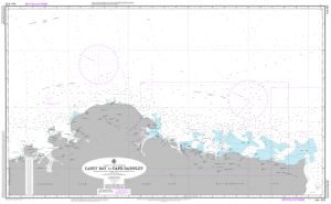
Map 310: Aus 402 Australian Antarctic Territory - Casey Bay to Cape Darnley
Map details
| Map Number | 310 |
| Title | Aus 402 Australian Antarctic Territory - Casey Bay to Cape Darnley |
| Edition | - |
| Scale | 1 : 1 000 000 |
| Publication date | 1965 |
| Publisher |
Hydrographic Service, Department of the Navy, Wollongong (Australia)
|
| Spatial coverage |
( 45.0000° -62.4333°)
,
( 71.1667° -62.4333°)
,
( 71.1667° -68.8333°)
( 45.0000° -68.8333°) |
| Projection | Mercator |
| Physical size | 73 x 119 cm |
| Notes | No longer maintained by Australian Hydrographic Office |
| Reference | Aus 402 |
| Keywords | Mawson Coast , Enderby Land , Kemp Land , Aus 402 , Nautical , Chart |
Downloads
No downloads available.
This is a hard copy map. See information about obtaining copies of hard copy maps.
Map Lists
This map belongs to the following lists. Use the link on the list to see all maps belonging to that list
Additional Information
| Vertical datum | Mean sea level |
Preview