Map 3559: Coulman Island
Map details
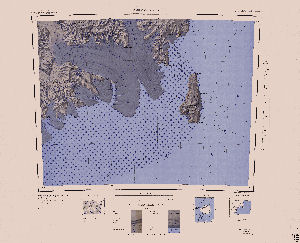
| Map Number | 3559 |
| Title | Coulman Island |
| Edition | - |
| Scale | 1 : 250 000 |
| Publication date | 1969 |
| Publisher |
US Geological Survey (United States of America)
|
| Spatial coverage |
(166.5000° -73.0000°)
,
(171.0000° -73.0000°)
,
(171.0000° -74.0000°)
(166.5000° -74.0000°) |
| Projection | Lambert Conformal Conic |
| Physical size | 66 x 82 cm |
| Notes | Antarctica 1:250,000 reconnaissance series |
| Reference | SS 58-60/6 |
| Keywords | Coulman Island , Daniell Peninsula , Malta Plateau , Mariner Glacier , Borchgrevink Glacier , Mountaineer Range , Malta Plateau , Argonaut Glacier , Meander Glacier , Topographic |
Downloads
Map Lists
This map belongs to the following lists. Use the link on the list to see all maps belonging to that list
Additional Information
| Vertical datum | Mean Sea Level |
| Nomenclature | U.S Board on Geographic Names |
Preview