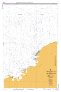
Map 386: Aus 451 Australian Antarctic Territory - Sandefjord Bay to Cape Rundingen
Map details
| Map Number | 386 |
| Title | Aus 451 Australian Antarctic Territory - Sandefjord Bay to Cape Rundingen |
| Edition | - |
| Scale | 1 : 500 000 |
| Publication date | January 1992 |
| Publisher |
Hydrographic Service, Department of the Navy, Wollongong (Australia)
|
| Spatial coverage |
( 73.1667° -65.7500°)
,
( 81.0000° -65.7500°)
,
( 81.0000° -70.3333°)
( 73.1667° -70.3333°) |
| Projection | Mercator |
| Physical size | 110 x 73 cm |
| Notes | Small corrections between editions. |
| Reference | Aus 451, M3, INT 9030, chart |
| Keywords | Aus 451 , Sandefjord Bay , Cape Rundingen , Int 9030 , Nautical , Chart |
Downloads
Map Lists
This map belongs to the following lists. Use the link on the list to see all maps belonging to that list
Additional Information
| Horizontal datum | WGS84 |
| Vertical datum | LAT |
Preview