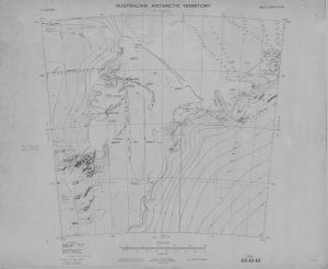
Map 484: SR 42-43
Map details
| Map Number | 484 |
| Title | SR 42-43 |
| Edition | - |
| Previous edition | [Previous edition : ] |
| Scale | 1 : 1 000 000 |
| Publication date | September 1965 |
| Publisher |
Australia
|
| Spatial coverage |
( 66.0000° -68.0000°)
,
( 78.0000° -68.0000°)
,
( 78.0000° -72.0000°)
( 66.0000° -72.0000°) |
| Projection | Lambert Conformal Conic |
| Physical size | 56 x 68.7 cm |
| Notes |
Includes Vestfold Hills. This map is superseded by map 126 (SR 41-42) and map 131 (SR 43-44). |
| Reference | SR 42-43 |
| Keywords | Prince Charles Mountains , Sandefjord Bay , Lambert Glacier , Prydz Bay , Mackenzie Bay , Amery Ice Shelf , Church Mountain , Davis |
Downloads
This is a hard copy map that has been scanned. See information about obtaining copies of hard copy maps.
Map Lists
No maps lists available.
Additional Information
| Vertical unit | Metres |
Preview