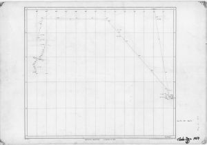
Map 654: Thala Dan 1959 / Mawson - Davis - Melbourne [Sheet 5]
Map details
| Map Number | 654 |
| Title | Thala Dan 1959 / Mawson - Davis - Melbourne [Sheet 5] |
| Edition | - |
| Scale | 1 : 1 000 000 |
| Publication date | 1959 |
| Publisher |
Australian Antarctic Division (Australia)
|
| Spatial coverage |
( 61.3330° -39.0000°)
,
(161.6600° -39.0000°)
,
(161.6600° -70.6660°)
( 61.3330° -70.6660°) |
| Projection | Mercator |
| Physical size | - |
| Notes | Background map drawn by the National Mapping Office, Department of the Interior, Australia |
| Reference | Sheet 5 |
| Keywords | Ship Tracks |
Downloads
This is a hard copy map that has been scanned. See information about obtaining copies of hard copy maps.
Map Lists
No maps lists available.
Additional Information
Preview