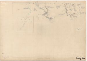
Map 713: Kista Dan 1956 [Sheet E]
Map details
| Map Number | 713 |
| Title | Kista Dan 1956 [Sheet E] |
| Edition | - |
| Scale | 1 : 1 000 000 |
| Publication date | 1956 |
| Publisher |
Australian Antarctic Division (Australia)
|
| Spatial coverage |
( 89.0000° -65.0000°)
,
(111.0000° -65.0000°)
,
(111.0000° -67.0000°)
( 89.0000° -67.0000°) |
| Projection | Mercator |
| Physical size | - |
| Notes | Shows aircraft flight with inset of Mawson Harbour approach |
| Keywords | Ship Tracks |
Downloads
This is a hard copy map that has been scanned. See information about obtaining copies of hard copy maps.
Map Lists
No maps lists available.
Additional Information
Preview