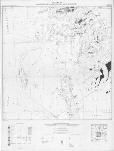
Map 8253: Geology of Mawson-Mulock area, Victoria Land, Antarctica, Sheet 2
Map details
| Map Number | 8253 |
| Title | Geology of Mawson-Mulock area, Victoria Land, Antarctica, Sheet 2 |
| Edition | 1st |
| Scale | 1 : 250 000 |
| Publication date | 1961 |
| Publisher |
Geophysics Division, Department of Scientific and Industrial Research (New Zealand)
|
| Spatial coverage |
(156.8333° -77.4667°)
,
(164.6667° -77.4667°)
,
(164.6667° -79.1000°)
(156.8333° -79.1000°) |
| Projection | Polar Stereographic |
| Physical size | 94.5 x 71.5 cm |
| Notes | Compiled by B.M. Gunn, G. Warren |
| Reference | Gunn, B.M. & Warren, G. 1962. Geology 4. Geology of Victoria Land between the Mawson and Mulock Glaciers, Antarctica. Trans-Antarctic Expedition 1955-1958 Scientific Reports, No. 11, 157 pp |
| Keywords | Geology , Mawson , Mulock , Skelton Glacier , Mulock Glacier , Taylor Glacier , Lashley Mountains , Royal Society Range , Worcester Range , Koettlitz Glacier |
Downloads
No downloads available.
Map Lists
This map belongs to the following lists. Use the link on the list to see all maps belonging to that list
Additional Information
Preview