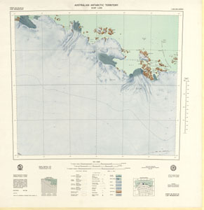
Map 86: Sheet SQ 40-41/14, Law Promontory, Australian Antarctic Territory, Kemp Land [SQ 39-40/16]
Map details
| Map Number | 86 |
| Title | Sheet SQ 40-41/14, Law Promontory, Australian Antarctic Territory, Kemp Land [SQ 39-40/16] |
| Edition | 1 |
| Scale | 1 : 250 000 |
| Publication date | May 1966 |
| Publisher |
Department of National Development, Division of National Mapping (Australia)
|
| Spatial coverage |
( 57.0000° -67.0000°)
,
( 60.0000° -67.0000°)
,
( 60.0000° -68.0000°)
( 57.0000° -68.0000°) |
| Projection | Universal Transverse Mercator |
| Physical size | 67 x 67 cm |
| Notes | Law Promontory SQ 40-41/14 have been numbered according to a map numbering system adopted by Department of National Mapping in 1967 for the 1:250,000 series which is different from that adopted for the 1:1 million map series in 1974. The map should now be quoted as SQ 39-40/16. |
| Reference |
SQ40-41/14 Cat.No:M19 in 'ANARE Catalogue of Maps and Hydrographic Charts 1997' |
| Keywords | Law Promontory , Kemp Land , Sq40-41/14 , Hoseason Glacier , Long Sound , Broka Island , Cirque Fjord , Stefansson Bay , Dovers , Fold , William Scoresby , Archipelago , Macfie Sound , Round Bay , Gwynn Bay , Bell Bay , Survey Marks , Topographic |
Downloads
This is a hard copy map that has been scanned. See information about obtaining copies of hard copy maps.
Map Lists
This map belongs to the following lists. Use the link on the list to see all maps belonging to that list
Additional Information
| Horizontal datum | International Spheroid |
| Nomenclature | Australian Antarctic Gazetteer |
Preview