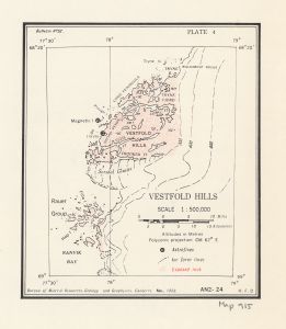
Map 915: Vestfold Hills
Map details
| Map Number | 915 |
| Title | Vestfold Hills |
| Edition | 1 |
| Scale | 1 : 50 000 |
| Publication date | November 1958 |
| Publisher |
Bureau of Mineral Resources, Geology and Geophysics, Department of National Development, Canberra (Australia)
|
| Spatial coverage |
( 77.5000° -68.3333°)
,
( 79.0000° -68.3333°)
,
( 79.0000° -69.0000°)
( 77.5000° -69.0000°) |
| Projection | Polyconic |
| Physical size | 20.5 x 19.2 cm |
| Notes | Published in BMR bulletin no. 52. Included in ANARE Reports Series A, Vol. III : Geology. A contribution to the geology and glaciology of the western part of Australian Antarctic Territory by P.W. Crohn. Melbourne: Antarctic Division, Sept. 1959 |
| Reference | AN 2-24 - Plate 4 |
| Keywords | An2-24 , Tryne Fjord , Ellis Fjord , Magnetic Island , Long Peninsula , Geology |
Downloads
This is a hard copy map that has been scanned. See information about obtaining copies of hard copy maps.
Map Lists
No maps lists available.
Additional Information
Preview