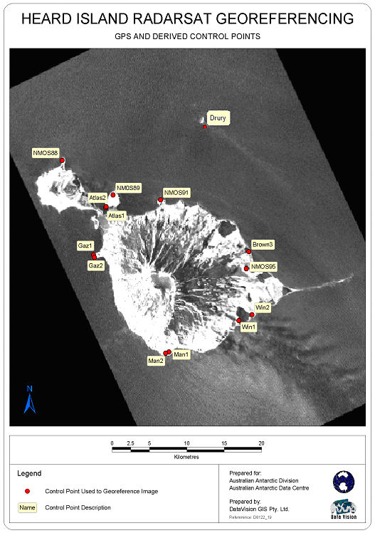
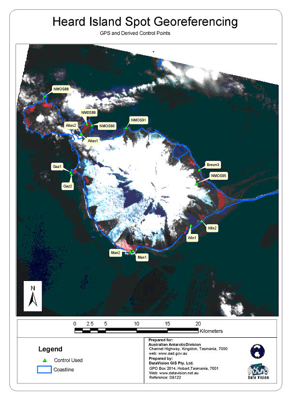
NMOS89 station information
Station identification
- Primary name
- NMOS89
Locality
Dovers Crater
View place name details in the gazetteer
Type
NGCP Control - Station 40615
This station is part of the Geoscience Australia National Geodetic Data Base - you will have to renavigate to the station page.
General
- Date last visited
-
No visits or not recorded (if present then see metadata record)
- Date last maintained
- Location details
| Coordinates |
| Datum | Latitude | Longitude | Accuracy (m) | Order | Grid | Easting | Northing | Date released | Status |
| ITRF2000 |
-53° 0' 21.904300"
-53.00608453 |
73° 24' 14.085100"
73.40391253 |
0.13 |
|
43 |
392904.850 |
4125861.090 |
1-Sep-2001 |
Current |
| WGS84 |
-53° 0' 21.949000"
-53.00609694 |
73° 24' 14.114300"
73.40392064 |
|
4 |
43 |
392905.420 |
4125859.720 |
|
Current |
| WGS84 |
-53° 0' 21.949000"
-53.00609694 |
73° 24' 14.114300"
73.40392064 |
|
4 |
43 |
392905.420 |
4125859.720 |
|
Superseded |
|
Orthometric
Heights |
| Datum | Height (m) | Accuracy (m) | Order | Date released | Status |
| |
97 |
|
4 |
|
Current |
|
| Documents |
| Type | Name/Photo/Sketch thumbnail |
| Photo Identification |
View image
|
| Photo Identification |
View image
|
| Satellite Image |
No Image Available
Satellite Image Catalogue - View Reference 
Pixel on image - X=1877.6106 (residual 0.7356) Y=374.2133 (residual -0.1617)
|
| Satellite Image |
No Image Available
Satellite Image Catalogue - View Reference
Pixel on image - X=671.8261 (residual -1.5489) Y=634.7358 (residual -0.6392)
|
| Satellite Image |
Satellite Image Catalogue - Image Id 1977 not in the Satellite Image Catalogue.
|
| Satellite Image |
Satellite Image Catalogue - Image Id 1978 not in the Satellite Image Catalogue.
|
| Station Summary |
View image
|
|
There are no nearby stations within 0.25 degrees of this station.