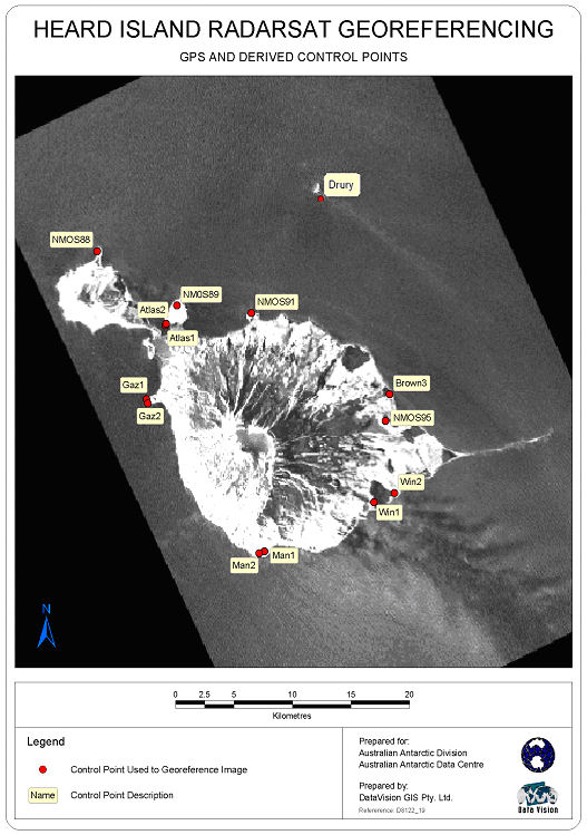
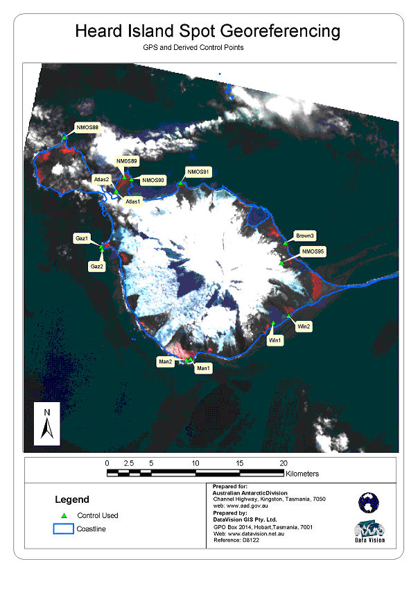
NMOS95 station information
Station identification
- Primary name
- NMOS95
Locality
Scarlet Hill
View place name details in the gazetteer
Type
NGCP Control - Station 45048
This station is part of the Geoscience Australia National Geodetic Data Base - you will have to renavigate to the station page.
General
- Date last visited
-
No visits or not recorded (if present then see metadata record)
- Date last maintained
- Location details
| Coordinates |
| Datum | Latitude | Longitude | Accuracy (m) | Order | Grid | Easting | Northing | Date released | Status |
| ITRF2000 |
-53° 5' 44.869300"
-53.09579703 |
73° 39' 59.406200"
73.66650172 |
0.18 |
|
43 |
410708.880 |
4116241.800 |
1-Sep-2001 |
Current |
|
Orthometric
Heights |
| Datum | Height (m) | Accuracy (m) | Order | Date released | Status |
| MSL |
409.18 |
|
4 |
30-Aug-2001 |
Current |
|
| Documents |
| Type | Name/Photo/Sketch thumbnail |
| Photo Identification |
View image
|
| Photo Identification |
View image
|
| Photo Identification |
View image
|
| Photo Identification |
View image
|
| Satellite Image |
No Image Available
Satellite Image Catalogue - View Reference 
Pixel on image - X=2856.5846 (residual 1.7096) Y=634.751 (residual 1.626)
|
| Satellite Image |
No Image Available
Satellite Image Catalogue - View Reference
Pixel on image - X=1637.9272 (residual -2.9478) Y=949.5033 (residual 1.8783)
|
| Satellite Image |
Satellite Image Catalogue - Image Id 1977 not in the Satellite Image Catalogue.
|
| Satellite Image |
Satellite Image Catalogue - Image Id 1978 not in the Satellite Image Catalogue.
|
| Station Summary |
View image
|
|
There are no nearby stations within 0.25 degrees of this station.