Snezhnyy Bay
Snezhnyy Bay (The name as it would appear in a gazetteer)
Snezhnyy Bay (The name as it would appear on a map)
If this information is incorrect, please e-mail mapping@aad.gov.au
Place ID: 13571
Name ID: 136
Feature type:
Bay
Origin
This name originates from Australia.
It is part of the
Australian Antarctic Gazetteer and the SCAR Composite Gazetteer of Antarctica.
Names that other countries have for this feature:
Narrative
A bay with a very narrow entrance in the northern part of the Vestfold Hills. Photographed by USN Operation Highjump (1946-47), the Soviet Antarctic Expedition in 1956 and ANARE in 1957 and 1958.
Named For
Named Zaliv Snezhnyy (Snowy Bay or Bight) by the Soviet Expedition.
Location
Latitude:
68° 26' 20.8" S
-68.43911°
Accurate to 30m
Longitude:
78° 26' 35.5" E
78.44319°
Accurate to 30m
Altitude:
0 m
Unknown precision
Images
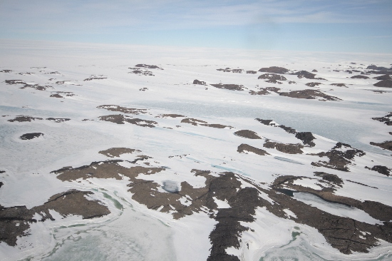
©Nathan Saunders 2009
- Catalogue id
- IA21993
- Caption
- Snezhnyy Bay, Vestfold Hills. Taken from helicopter at height of 1500 feet. Looking South.
- Photographer
- Saunders, Nathan
Map
Source
Location Method:
Topographic data
Source Name:
Vestfold Hills Topographic GIS Dataset
Source Identifier:
vest_hills_gis
Source Institution:
Australian Antarctic Division
Source Publisher:
Australian Antarctic Division
Remote sensing:
Not Applicable
Comments
Metadata for coordinates and origin of topographic data.
Approval status
Date approved:
27-Nov-1973
Related information