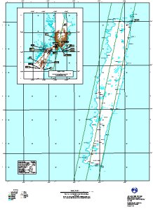
Map 11465: Macquarie Island survey and photo control and proposed aerial photography (height 3000 m) 1999-2000
Map details
| Map Number | 11465 |
| Title | Macquarie Island survey and photo control and proposed aerial photography (height 3000 m) 1999-2000 |
| Edition | 1 |
| Scale | 1 : 50 000 |
| Publication date | June 1999 |
| Publisher |
Australian Antarctic Division (Australia)
|
| Spatial coverage |
(158.5000° -54.4167°)
,
(159.0000° -54.4167°)
,
(159.0000° -54.8333°)
(158.5000° -54.8333°) |
| Projection | Universal Transverse Mercator |
| Physical size | - |
| Keywords | Topographic |
Downloads
No downloads available.
Map Lists
No maps lists available.
Additional Information
Preview