Map 12420: Casey Station Fire Hydrants
Map details
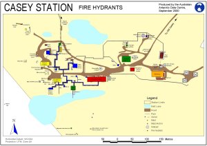
| Map Number | 12420 |
| Title | Casey Station Fire Hydrants |
| Edition | 2 (Out of Date) |
| Previous edition | [Previous edition : 1] |
| Next Edition | [Next Edition : 3] |
| Scale | 1 : 2600 |
| Publication date | September 2000 |
| Publisher |
Australian Antarctic Division (Australia)
|
| Spatial coverage |
(110.5190° -66.2807°)
,
(110.5360° -66.2807°)
,
(110.5360° -66.2843°)
(110.5190° -66.2843°) |
| Projection | Universal Transverse Mercator |
| Physical size | 21 x 29.7 cm A4 |
| Notes | This information has been superceded by the Fire Response Guidelines available at: http://records.aad.gov.au/api/record/488499/LatestFinalFile |
| Keywords | - |
Downloads
This is a digital map available for downloading.
Map Lists
No maps lists available.
Additional Information
Preview