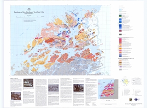
Map 12717: Geology of the Northern Vestfold Hills, East Antarctica
Map details
| Map Number | 12717 |
| Title | Geology of the Northern Vestfold Hills, East Antarctica |
| Edition | 1 |
| Scale | 1 : 30 000 |
| Publication date | May 2001 |
| Publisher |
Australian Antarctic Division (Australia)
Australian Geological Survey Organisation (Australia) |
| Spatial coverage |
( 78.0000° -68.4000°)
,
( 78.5833° -68.4000°)
,
( 78.5833° -68.5500°)
( 78.0000° -68.5500°) |
| Projection | Universal Transverse Mercator |
| Physical size | 85 x 110 cm |
| Keywords | Snape , Seitz , Bain |
Downloads
This is a hard copy map that has been scanned. See information about obtaining copies of hard copy maps.
Map Lists
This map belongs to the following lists. Use the link on the list to see all maps belonging to that list
Additional Information
| Accuracy |
Horizontal accuracy: +/-2m Vertical accuracy: +/-2m Dykes:+/-2m, interpretation aerial photography Spot heights: +/-2m Geological formations: For information about this dataset refer to the metadata record. |
| Horizontal datum | WGS 84 |
| Vertical datum | Mean Sea Level |
| Nomenclature | Australian Antarctic Gazetteer |
Preview