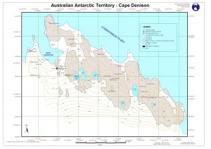
Map 12718: Australian Antarctic Territory - Cape Denison
Map details
| Map Number | 12718 |
| Title | Australian Antarctic Territory - Cape Denison |
| Edition | 1 (Out of Date) |
| Next Edition | [Next Edition : 2] |
| Scale | 1 : 5000 |
| Publication date | February 2001 |
| Publisher | - |
| Spatial coverage |
(142.6528° -67.0042°)
,
(142.6911° -67.0042°)
,
(142.6911° -67.0144°)
(142.6528° -67.0144°) |
| Projection | Universal Transverse Mercator |
| Physical size | 32 x 43 cm A3 |
| Notes | Topographic map compiled from detail survey by G.Crispo in December 1985 |
| Keywords | Cape Denison , Commonwealth Bay , Boat Harbour , Mawson's Hut , Survey Marks , Topographic |
Downloads
This is a digital map available for downloading.
Map Lists
No maps lists available.
Additional Information
| Horizontal datum | WGS84 |
| Vertical datum | Mean Sea Level |
| Magnetic variation | Not shown |
| Nomenclature | Australian Antarctic Gazetteer |
Preview