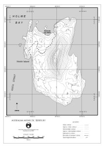
Map 12723: Welch Island topographical map
Map details
| Map Number | 12723 |
| Title | Welch Island topographical map |
| Edition | 1 |
| Scale | 1 : 10 000 |
| Publication date | July 2000 |
| Publisher |
Australian Antarctic Division (Australia)
|
| Spatial coverage |
( 62.9083° -67.5500°)
,
( 62.9500° -67.5500°)
,
( 62.9500° -67.5722°)
( 62.9083° -67.5722°) |
| Projection | Universal Transverse Mercator |
| Physical size | 2.97 x 2.1 cm A4 |
| Keywords | Welch Island , Penguin Colonies , Topographic |
Downloads
This is a digital map available for downloading.
Map Lists
This map belongs to the following lists. Use the link on the list to see all maps belonging to that list
Additional Information
| Nomenclature | Australian Antarctic Gazetteer |
Preview