Map 12817: Heard Island and McDonald Islands / Scientific Research
Map details
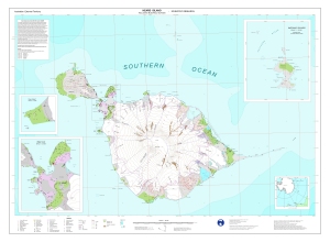
| Map Number | 12817 |
| Title | Heard Island and McDonald Islands / Scientific Research |
| Edition | 1 |
| Scale | 1 : 50 000 |
| Publication date | June 2002 |
| Publisher |
Australian Antarctic Division (Australia)
|
| Spatial coverage |
( 73.1200° -52.8700°)
,
( 73.9700° -52.8700°)
,
( 73.9700° -53.2300°)
( 73.1200° -53.2300°) |
| Projection | Universal Transverse Mercator |
| Physical size | 83 x 115 cm A0 |
| Keywords | Heard , Science , Flora , Fauna , Biology , Botany , Zoology , Geomorphology , Penguin , Bird , Seal , Glacier , Topography , Historical , Archaeology |
Downloads
This is a digital map available for downloading.
Map Lists
This map belongs to the following lists. Use the link on the list to see all maps belonging to that list
Additional Information
| Horizontal datum | WGS84 |
| Vertical datum | Mean sea level |
| Magnetic variation | 60 degrees west |
| Nomenclature | Australian Antarctic Gazetteer |
Preview