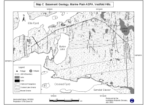
Map 12969: Basement Geology, Marine Plain ASPA, Vestfold Hills. Map C
Map details
| Map Number | 12969 |
| Title | Basement Geology, Marine Plain ASPA, Vestfold Hills. Map C |
| Edition | 1 (Out of Date) |
| Next Edition | [Next Edition : 2] |
| Scale | 1 : 47 600 |
| Publication date | July 2002 |
| Publisher |
Australian Antarctic Division (Australia)
|
| Spatial coverage |
( 78.0000° -68.6000°)
,
( 78.2500° -68.6000°)
,
( 78.2500° -68.6667°)
( 78.0000° -68.6667°) |
| Projection | Universal Transverse Mercator |
| Physical size | 15 x 20 cm |
| Notes | Map produced for the Management Plan of ASPA 143 |
| Keywords | Marine Plain , ASPA , Antarctic Specially Protected Area , Burton Lake , Crooked Fjord , Sorsdal Glacier , Lebed Lake |
Downloads
This is a digital map available for downloading.
Map Lists
No maps lists available.
Additional Information
| Horizontal datum | WGS84 |
| Vertical datum | Mean Sea Level |
| Nomenclature | Australian Antarctic Gazetteer |
Preview