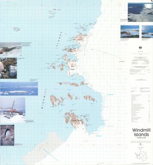
Map 13008: Windmill Islands, Wilkes Land
Map details
| Map Number | 13008 |
| Title | Windmill Islands, Wilkes Land |
| Edition | 1 (Out of Date) |
| Next Edition | [Next Edition : 2] |
| Scale | 1 : 50 000 |
| Publication date | November 1989 |
| Publisher |
Australian Surveying and Land Information Group, Department of Administrative Services, Canberra (Australia)
|
| Spatial coverage |
(110.0833° -66.1667°)
,
(110.8667° -66.1667°)
,
(110.8667° -66.5833°)
(110.0833° -66.5833°) |
| Projection | Universal Transverse Mercator |
| Physical size | 96 x 88 cm |
| Notes | This map was published as a double-sided map. This entry in the map catalogue refers to the edition 1 of the topographic map. Refer to Map No: 13012 for the satellite image map. |
| Keywords | Windmill Islands , Frazier Islands , Donovan Islands , Wilkes , Swain Group , Clark Peninsula , Lanyon Junction , S1 , Bailey Peninsula , Mitchell Peninsula , Robinson Ridge , Browning Peninsula , Vanderford Glacier , Shirley , Ardery , Beall , Midgeley , Pidgeon , Cronk , Warrington , Odbert , Holl , Ford , Cloyd , Herring , Motherway , Peterson , Wilson , Boffa , Bosner , Teigan , Birkenhauer Island , Survey Marks , Topographic |
Downloads
This is a hard copy map that has been scanned. See information about obtaining copies of hard copy maps.
Map Lists
This map belongs to the following lists. Use the link on the list to see all maps belonging to that list
Additional Information
| Horizontal datum | WGS84 |
| Vertical datum | Mean Sea Level |
| Nomenclature | Australian Antarctic Gazetteer |
Preview