Map 13043: Adelie penguin colonies near Mawson Station
Map details
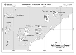
| Map Number | 13043 |
| Title | Adelie penguin colonies near Mawson Station |
| Edition | 1 |
| Scale | 1 : 58 000 |
| Publication date | June 2003 |
| Publisher | - |
| Spatial coverage |
( 62.7417° -67.5000°)
,
( 63.1333° -67.5000°)
,
( 63.1333° -67.6667°)
( 62.7417° -67.6667°) |
| Projection | Universal Transverse Mercator |
| Physical size | - |
| Notes | An error in the scale was corrected 19 January 2005 |
| Keywords | Adelie Penguin Colonies , Van Hulssen Islands , Kellas Islands , Klung Islands , Welch Island , Verner Island , Petersen Island , Jocelyn Islands , Teyssier Island , Bechervaise Island , Stinear Island , Flat Islands , Evans Island , Lee Island , Mawson , Departure Rocks |
Downloads
This is a digital map available for downloading.
Map Lists
This map belongs to the following lists. Use the link on the list to see all maps belonging to that list
Additional Information
| Horizontal datum | WGS84 |
| Nomenclature | Australian Antarctic Names Gazetteer |
Preview