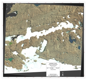
Map 13048: Marine Plain : Satellite image map, Vestfold Hills
Map details
| Map Number | 13048 |
| Title | Marine Plain : Satellite image map, Vestfold Hills |
| Edition | 1 |
| Scale | 1 : 20 000 |
| Publication date | October 2003 |
| Publisher |
Australian Antarctic Division (Australia)
|
| Spatial coverage |
( 83.9500° -68.5667°)
,
( 84.2500° -68.5667°)
,
( 84.2500° -68.6583°)
( 83.9500° -68.6583°) |
| Projection | Universal Transverse Mercator |
| Physical size | 61.5 x 67 cm |
| Notes | Digital Globe Multi Spectral Image. Image acquired : 13 January 2003. |
| Keywords | Marine Plain , Vestfold Hills , Ellis Fjord , Burton Lake , Adamson Bay , Clear Lake , Laternula Lake , Cemetary Lake , Lebed Lake , Oblong Lake , Crooked Fjord , Satellite Imagery |
Downloads
This is a digital map available for downloading.
Map Lists
This map belongs to the following lists. Use the link on the list to see all maps belonging to that list
- Vestfold Hills / Davis - extended list
- Satellite image maps
- Antarctic Specially Protected Areas and Antarctic Specially Managed Areas maps
Additional Information
| Horizontal datum | WGS84 |
Preview