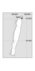
Map 13141: Macquarie Island [Black and white]
Map details
| Map Number | 13141 |
| Title | Macquarie Island [Black and white] |
| Edition | 1 |
| Scale | 1 : c661 160 |
| Publication date | May 2005 |
| Publisher |
Australian Antarctic Division (Australia)
|
| Spatial coverage |
(158.6667° -54.4333°)
,
(159.1167° -54.4333°)
,
(159.1167° -54.8000°)
(158.6667° -54.8000°) |
| Projection | Universal Transverse Mercator |
| Physical size | 5.7 x 3.8 cm |
| Keywords | - |
Downloads
This is a digital map available for downloading.
Map Lists
This map belongs to the following lists. Use the link on the list to see all maps belonging to that list
Additional Information
| Horizontal datum | WGS84 |
Preview