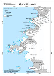
Map 13196: Windmill Islands Flight lines and photograph centres from the Linhof camera, December 1990
Map details
| Map Number | 13196 |
| Title | Windmill Islands Flight lines and photograph centres from the Linhof camera, December 1990 |
| Edition | - |
| Scale | 1 : 50 000 |
| Publication date | October 2005 |
| Publisher |
Australian Antarctic Division (Australia)
|
| Spatial coverage |
(110.3500° -66.2167°)
,
(110.6500° -66.2167°)
,
(110.6500° -66.4000°)
(110.3500° -66.4000°) |
| Projection | Universal Transverse Mercator |
| Physical size | 42 x 29.7 cm A3 |
| Keywords | - |
Downloads
This is a digital map available for downloading.
Map Lists
No maps lists available.
Additional Information
Preview