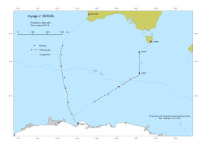
Map 13303: Voyage 2 2005/06
Map details
| Map Number | 13303 |
| Title | Voyage 2 2005/06 |
| Edition | - |
| Scale | 1 : 22 600 000 |
| Publication date | August 2006 |
| Publisher |
Australian Antarctic Division (Australia)
|
| Spatial coverage |
( 77.8167° -30.6167°)
,
(168.7500° -30.6167°)
,
(168.7500° -68.7333°)
( 77.8167° -68.7333°) |
| Projection | Mercator |
| Physical size | - |
| Notes | This map shows the track of voyage 2 of the Australian Antarctic Program 2005/06. |
| Keywords | Track , Cpr , Transect , Mooring , Continuous Plankton Recorder , Sazb , Sazc , Ship Tracks |
Downloads
This is a digital map available for downloading.
Map Lists
This map belongs to the following lists. Use the link on the list to see all maps belonging to that list
Additional Information
| Horizontal datum | WGS84 |
Preview