Map 1332: Antarctic Ocean
Map details
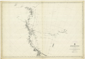
| Map Number | 1332 |
| Title | Antarctic Ocean |
| Edition | - |
| Scale | Not Entered |
| Publication date | 1901 |
| Publisher | - |
| Spatial coverage | No spatial coverage entered. |
| Projection | Not Given |
| Physical size | - |
| Notes | Showing ship Track Chart from the 1840's - Part of Capt. J.K. Davis Collection. Scanned image available - please contact Aust. Antarctic Data Centre. Original map held at the National Archives of Australia (Hobart Office) |
| Reference | Sheet III - 3172 |
| Keywords | Captain J.K. Davis Collection , Ship Tracks |
Downloads
No downloads available.
Map Lists
This map belongs to the following lists. Use the link on the list to see all maps belonging to that list
Additional Information
Preview
Map extent
No extents available