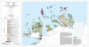
Map 13379: Geology of the Larsemann Hills
Map details
| Map Number | 13379 |
| Title | Geology of the Larsemann Hills |
| Edition | 1 |
| Scale | 1 : 25 000 |
| Publication date | July 2007 |
| Publisher |
Geoscience Australia (Australia)
|
| Spatial coverage |
( 75.9000° -69.3333°)
,
( 76.5500° -69.3333°)
,
( 76.5500° -69.4667°)
( 75.9000° -69.4667°) |
| Projection | Universal Transverse Mercator |
| Physical size | 64 x 121 cm |
| Notes |
Compiled by C.J. Carson, E.S. Grew (2004) and D.E. Thost (1997) Published jointly by the Australian Antarctic Division and Geoscience Australia |
| Keywords | Larsemann Hills , Dalk Glacier , Thala Fjord , Quilty Bay , Wilcock Bay , Clemence Fjord , Nella Fjord , Mcleod Island , Osmar Island , Barry Jones Bay , Donovan Promontory , Manning Island , Lovering Island , Lied Promontory , Fisher Island , Sandercock Island , Easther Island , Betts Island , Stornes , Grovnes , Broknes , Geology |
Downloads
This is a digital map available for downloading.
Map Lists
This map belongs to the following lists. Use the link on the list to see all maps belonging to that list
Additional Information
| Horizontal datum | WGS84 |
| Vertical datum | Mean sea level |
| Magnetic variation | Grid/Magnetic angle 77 deg 28 min. Magnetic North moves westerly by approx. 8 min per year. |
| Nomenclature | Australian Antarctic Names and Medals Committee |
Preview