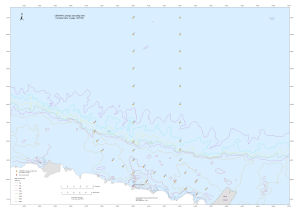
Map 13460: CEAMARC benthic sampling sites: Umitaka Maru voyage 2007/08
Map details
| Map Number | 13460 |
| Title | CEAMARC benthic sampling sites: Umitaka Maru voyage 2007/08 |
| Edition | 1 |
| Scale | 1 : 1 100 000 |
| Publication date | January 2008 |
| Publisher |
Australian Antarctic Division (Australia)
|
| Spatial coverage |
(132.2147° -61.7122°)
,
(149.9519° -61.7122°)
,
(149.9519° -67.1133°)
(132.2147° -67.1133°) |
| Projection | Mercator |
| Physical size | 59.4 x 84.1 cm A1 |
| Notes |
The map shows the Collaborative East Antarctic Marine Census (CEAMARC) pelagic sampling locations to be visited during a voyage by the Umitaka Maru during the 2007/08 season. CEAMARC is undertaking a comprehensive survey of the plankton, fish, benthos and oceanography of the area north of Terre Adélie and George V Land of Eastern Antarctica. |
| Keywords | Ceamarc Pelagic Sampling Sites , Collaborative East Antarctic Marine Census , Umitaka Maru , 2007/08 |
Downloads
This is a digital map available for downloading.
Map Lists
This map belongs to the following lists. Use the link on the list to see all maps belonging to that list
Additional Information
| Horizontal datum | WGS84 |
Preview