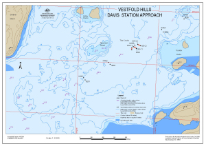
Map 13563: Vestfold Hills Davis Station approach : Map 5 of 6
Map details
| Map Number | 13563 |
| Title | Vestfold Hills Davis Station approach : Map 5 of 6 |
| Edition | 1 |
| Scale | 1 : 8500 |
| Publication date | October 2008 |
| Publisher |
Australian Antarctic Division (Australia)
|
| Spatial coverage |
( 77.8683° -68.5753°)
,
( 77.9528° -68.5753°)
,
( 77.9528° -68.5936°)
( 77.8683° -68.5936°) |
| Projection | Universal Transverse Mercator |
| Physical size | - |
| Notes |
Map produced in limited time to aid planning for the emergency evacuation of an injured expeditioner from Davis. The map includes waypoints showing where flags had been placed marking out the runway prepared for the evacuation: NW01 to NW05, SE01 to SE05. |
| Keywords | Proposed Emergency Runway , Tide Cracks , Waypoints , Gardner Island , Hobby Rocks , Torckler Rocks , Emergency Evacuation |
Downloads
This is a digital map available for downloading.
Map Lists
No maps lists available.
Additional Information
| Horizontal datum | WGS84 |
| Vertical datum | msl |
Preview