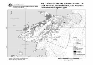
Map 13597: Antarctic Specially Protected Area No. 136, Clark Peninsula, Windmill Islands, East Antarctica.
Map C:Distribution of major vegetation types.
Map details
| Map Number | 13597 |
| Title | Antarctic Specially Protected Area No. 136, Clark Peninsula, Windmill Islands, East Antarctica. Map C:Distribution of major vegetation types. |
| Edition | 3 (Out of Date) |
| Previous edition | [Previous edition : 2] |
| Next Edition | [Next Edition : 4] |
| Scale | 1 : 30 000 |
| Publication date | February 2009 |
| Publisher | - |
| Spatial coverage |
(110.5000° -66.2333°)
,
(110.6667° -66.2333°)
,
(110.6667° -66.2750°)
(110.5000° -66.2750°) |
| Projection | Universal Transverse Mercator |
| Physical size | 21 x 29.7 cm A4 |
| Notes |
This map is included in the management plan for Antarctic Specially Protected Area No.136, Clark Peninsula, Budd Coast, Wilkes Land, 2009. Note that Noonan Cove is shown incorrectly on this map. It is the next cove to the west and south-west of the Wilkes Hilton refuge. |
| Keywords | Clark Peninsula , Windmill Islands , Antarctic Specially Protected Area No. 136 , Vegetation , ASPA 136 |
Downloads
This is a digital map available for downloading.
Map Lists
No maps lists available.
Additional Information
| Horizontal datum | WGS84 |
| Nomenclature | Australian Antarctic Names Gazetteer |
Preview