Map 13739: Grove Mountains : satellite image map
Map details
| Map Number | 13739 |
| Title | Grove Mountains : satellite image map |
| Edition | 3 |
| Previous edition | [Previous edition : 2] |
| Scale | 1 : 15 000 |
| Publication date | December 2009 |
| Publisher |
Australian Antarctic Division (Australia)
|
| Spatial coverage |
( 74.8250° -72.8417°)
,
( 75.2333° -72.8417°)
,
( 75.2333° -72.9333°)
( 74.8250° -72.9333°) |
| Projection | Universal Transverse Mercator |
| Physical size | 78.5 x 98 cm |
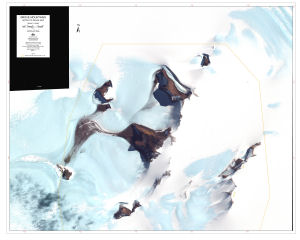
| Notes | The map features a Quickbird multispectral image acquired 14 January 2003, and the boundary of Antarctic Specially Protected Area No. 168. |
| Keywords | Grove Mountains , Mount Harding , Zakharoff Ridge , Antarctic Specially Protected Area 168 , Satellite Imagery |
Downloads
This is a digital map available for downloading.
Map Lists
This map belongs to the following lists. Use the link on the list to see all maps belonging to that list
- Satellite image maps
- Antarctic Specially Protected Areas and Antarctic Specially Managed Areas maps
- Grove Mountains
Additional Information
| Horizontal datum | WGS84 |
Preview