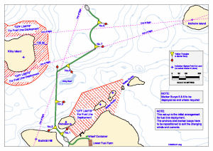
Map 13745: Casey refuelling: initial arrangement for fuel line deployment
Map details
| Map Number | 13745 |
| Title | Casey refuelling: initial arrangement for fuel line deployment |
| Edition | - |
| Scale | 1 : 5200 |
| Publication date | January 2010 |
| Publisher |
Australian Antarctic Division (Australia)
|
| Spatial coverage |
(110.4667° -66.2500°)
,
(110.5833° -66.2500°)
,
(110.5833° -66.2833°)
(110.4667° -66.2833°) |
| Projection | Universal Transverse Mercator |
| Physical size | 21 x 29.7 cm A4 |
| Notes |
Map produced by Brett Gogoll (Asset Management AAD). Two other maps have been produced by Brett for refuelling at Casey but are not publicly available. These maps show the approximate location for the resupply vessel when refuelling and have Map Catalogue numbers 13742 and 13743. Australian Antarctic Division personnel can request a pdf copy of these two maps from the Australian Antarctic Data Centre. |
| Keywords | - |
Downloads
This is a digital map available for downloading.
Map Lists
This map belongs to the following lists. Use the link on the list to see all maps belonging to that list
Additional Information
| Horizontal datum | WGS84 |
Preview