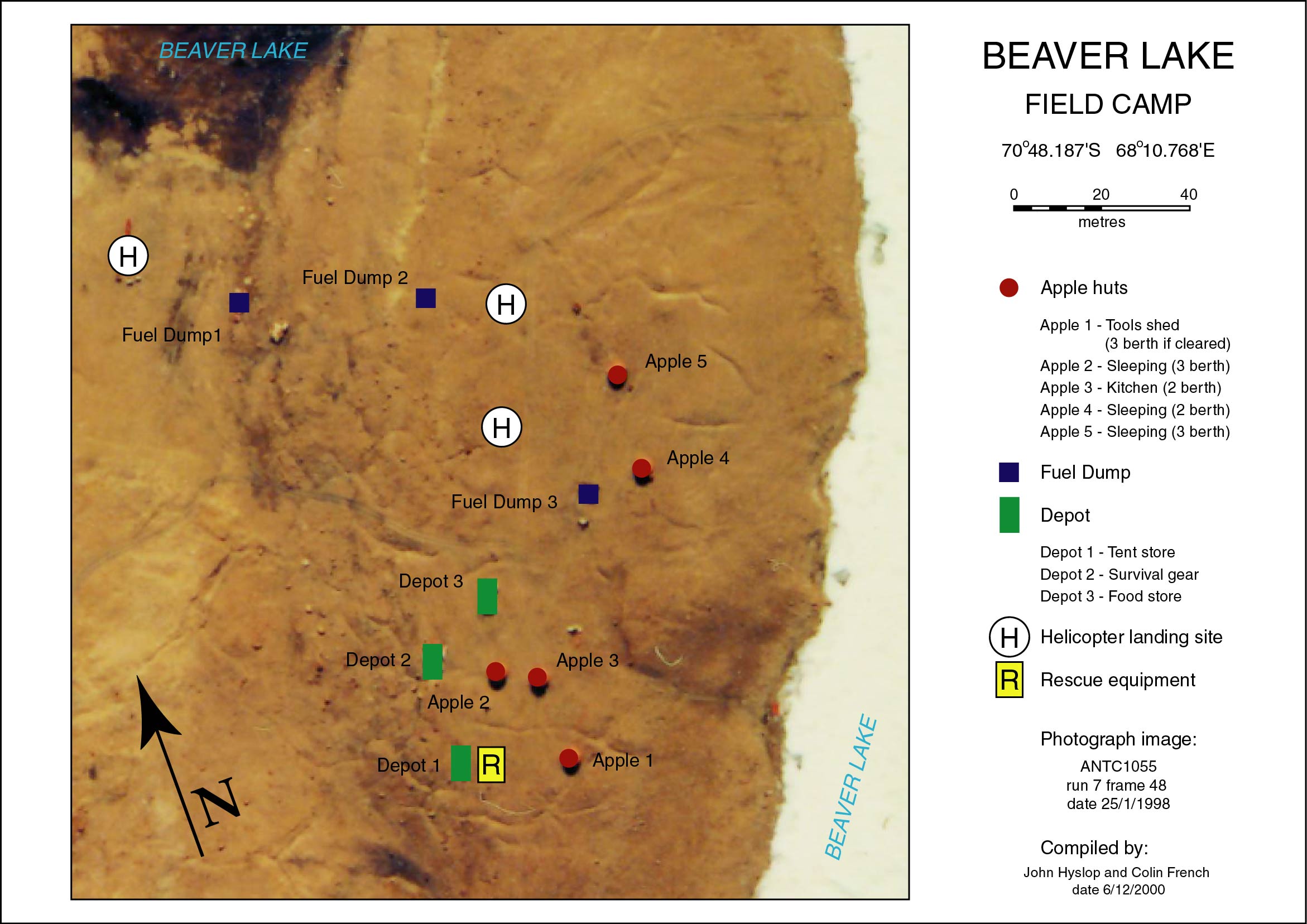
Map 13794: Beaver Lake Field Camp
Map details
| Map Number | 13794 |
| Title | Beaver Lake Field Camp |
| Edition | 1 |
| Scale | 1 : 1000 |
| Publication date | December 2000 |
| Publisher |
Australian Antarctic Division (Australia)
|
| Spatial coverage |
( 68.1751° -70.8015°)
,
( 68.1806° -70.8015°)
,
( 68.1806° -70.8036°)
( 68.1751° -70.8036°) |
| Projection | Universal Transverse Mercator |
| Physical size | 21.03 x 29.74 cm |
| Notes |
Compiled by John Hyslop and Colin French. Photograph image: ANTC1055 Run 7 Frame 48, date 25/1/1998 |
| Keywords | John Hyslop , Colin French , Photography , Antc1055 , Topographic |
Downloads
This is a digital map available for downloading.
Map Lists
This map belongs to the following lists. Use the link on the list to see all maps belonging to that list
Additional Information
| Horizontal datum | WGS84 |
Preview