Map 13799: South Shetland Islands : King George Island, Fildes Peninsula
Map details
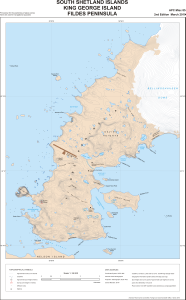
| Map Number | 13799 |
| Title | South Shetland Islands : King George Island, Fildes Peninsula |
| Edition | 2 |
| Scale | 1 : 25 000 |
| Publication date | March 2010 |
| Publisher |
UK Antarctic Place-names Committee (United Kingdom)
|
| Spatial coverage |
( -59.0433° -62.1342°)
,
( -58.8769° -62.1342°)
,
( -58.8769° -62.2392°)
( -59.0433° -62.2392°) |
| Projection | Polar Stereographic |
| Physical size | 62.5 x 41.8 cm |
| Notes |
Provisional for the positioning of place-names Not to be used for navigational purposes |
| Reference | APC Misc 85 |
| Keywords | Bellingshausen Dome , Nelson Island , Davies Heights , Ardley Island , Fildes Strait , Geographers Cove , Hydrographers Cove , Two Summit Island , Diomedea Island , Fildes Peninsula , Square End Island , Survey Marks , Topographic |
Downloads
This is a digital map available for downloading.
Map Lists
No maps lists available.
Additional Information
| Horizontal datum | WGS1984 |
| Nomenclature | BAT Gazetteer |
Preview