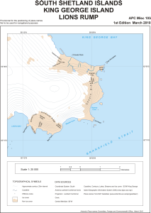
Map 13803: South Shetland Islands : King George Island, Lions Rump
Map details
| Map Number | 13803 |
| Title | South Shetland Islands : King George Island, Lions Rump |
| Edition | 1 |
| Scale | 1 : 25 000 |
| Publication date | March 2010 |
| Publisher |
UK Antarctic Place-names Committee (United Kingdom)
|
| Spatial coverage |
( -58.2058° -62.1183°)
,
( -58.0867° -62.1183°)
,
( -58.0867° -62.1739°)
( -58.2058° -62.1739°) |
| Projection | Polar Stereographic |
| Physical size | 36.6 x 28.4 cm |
| Notes |
Provisional for the positioning of place-names Not to be used for navigational purposes |
| Reference | APC Misc 103 |
| Keywords | South Shetland Islands , King George Island , Lions Rump , Chopin Ridge , Bransfield Strait , King George Bay , Dunikowski Ridge , Topographic |
Downloads
This is a digital map available for downloading.
Map Lists
No maps lists available.
Additional Information
| Horizontal datum | WGS84 |
| Nomenclature | BAT Gazetteer |
Preview