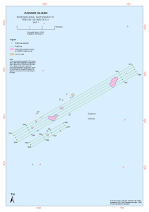
Map 13863: Svenner Islands
Proposed Aerial Photography of Penguin Colonies 2010-11
Map details
| Map Number | 13863 |
| Title | Svenner Islands Proposed Aerial Photography of Penguin Colonies 2010-11 |
| Edition | 1 |
| Scale | 1 : 40 000 |
| Publication date | September 2010 |
| Publisher |
Australian Antarctic Division (Australia)
|
| Spatial coverage |
( 76.7628° -68.9536°)
,
( 77.0353° -68.9536°)
,
( 77.0353° -69.0956°)
( 76.7628° -69.0956°) |
| Projection | Universal Transverse Mercator |
| Physical size | 42 x 29.7 cm A3 |
| Keywords | - |
Downloads
This is a digital map available for downloading.
Map Lists
No maps lists available.
Additional Information
| Horizontal datum | WGS84 |
Preview